Cities: Skylines

Cities: Skylines

1,355 ratings
Traffic Planning Guide for Realistic Cities
By Dimethylmercury
Utilizing modern planning theories, this comprehensive guide seeks to minimise traffic flow by building realistic cities.
7
3
4
2
2
7
3
2
2
2
   
Award
Favorite
Favorited
Unfavorite
About
This guide is originally written by Tulip In the Eye. Translated with his permission. Kazumi also helped with translation.

I am a student in Planning. As a kid, I’ve always loved drawing things from maps, or draw imaginary maps of mountains, rivers, and cities from my mind. I pre-ordered Cities:Skyline when I first heard of it, and now has accumulated more than 130 hours of gameplay. I’ve also been building my last city for a month and a half now.

The purpose of this guide is to share my knowledge in planning and experiences gained from playing the game with everyone. Rather than attempting to optimize cities for game mechanics, I try to utilise as much planning methodologies and theories as possible, to create truly realistic cities.

I also do not follow real-world maps as blueprints. For example, I do not use excessive ramps for the purpose of eliminating traffic signals in road grids; or avoiding congestion by having circular grid plans. I do, however, construct pedestrian bridges where necessary.

This guide integrates real-world urban planning theories and models with game mechanics of Cities: Skylines, in order to produce realistic cities which conform to game rules. Granted, these may not be the most optimal solution for the game, but it will make your cities a little bit more realistic.

For me, this is not just a game. This is city building. Let’s begin.

Traffic Sources
First, let us understand how traffic is generated and their operating rules.

There are two main types of traffic: commuting and cargo. In the game, passenger traffic consist mainly of commuters, as tourist trips are very minimal, so we will focus our discussion on commuter traffic. Cargo traffic is responsible for the movement of goods, particularly important in Industrial zones.

Commuting

The common Origin & Destination (O&D) pairs for commuting traffic include:
Residential >> Commercial;
Residential >> Office;
Residential >> Industrial;

A more complex trip would be something like this:
Residential >> Industrial/Office >> Commercial >> Residential;

So, of all these trips, Residential would be the Origin, and rest are Destinations.


This graph shows typical trips our cims make in a day. (The colours are representative of the zones: Residential - Green; Commercial - Blue; Office - Light Blue; Industrial - Yellow) As you increase population of your city, your city must be able to handle the increasing traffic activity. Below is an interchange in a 170k population city after public transit is switched off. Quite awful, isn’t it?


As with reality, the game provides public transit as means to reduce car usage. Here is the same interchange, of the same city, with functioning public transit. Much better!


We will discuss public transit more in-depth later on.

Cargo

Since public transit is quite effective at reducing vehicular traffic, the effects of commuting traffic is not too grave in most cities. A lot of players get headache when they see lots of trucks clogging up the industrial zone and haven’t a clue what’s going on… almost makes you want to de-zone the Industrials!


Industrial zones play a critical role in the game, however. Apart from providing employment, they also provide Commercial establishments with goods, and export their goods to other cities. Here is a graph of cargo movements in the game: (Export/intercity - Green; Commercial - Blue; Industrial - Yellow)


Cargo generates a lot of road traffic, which is difficult to handle sometimes. Fortunately, the game also provides trains and ships to alleviate this. Since goods are smart enough to switch between various modes of transport (i.e. truck >> train >> ship) to reach their final destination, well-integrated railroads and waterways can significantly reduce road usage for Cargoes.


Cargo harbours transport goods both inside and outside the city. This ship here is actually transporting goods from harbour in my Industrial zone to Commercial zone.
Zoning
The locations and relationships you choose between Residential, Commercial, Office, and Industrial zones all constitute what we call “Land-use Planning”, or “Zoning”. Of course, in real-world planning, you are not limited to just four types of land, making things much more complicated.

Since this is a traffic planning guide, why must we talk about zoning?

Zoning is the most fundamental part of your traffic. Zoning dictates the origins and destinations for all the traffic. We then build roads between O&D to connect them. A mismatch between zoning and traffic system is bound to end in chaos -- even interchanges and expressways cannot fix that.

An Ideal Zoning Model

Given that Passenger traffic is mainly between Residential and everything else, and Cargo traffic is between Commercial, Industrial, and Intercity, we can easily come up with this Serial Zoning Layout: (Intercity - Grey)


The Serial Zoning Layout is quite straightforward and easy to make in a grid-style road network. You’ve probably already used this yourself!
The advantage of this Zoning Layout is that Industrial and Commercial get plenty of interfacing, and traffic between the two of them will not interfere with rest of the city. Commuters also get a sweet short commute to the Office or shops. But it is a longer commute if cims work in Industrial. It also doesn’t work if you hate grids.

The Staggered Zoning Layout is also perfect for grid-style cities. In this layout, Residents have great access to all their destinations. However, there might not be enough interfacing between Commercial and Industrial, so that’s something to look out for.

Zoning Details
In real life, we do not see all the zones so ideally separated out. Commercial, Office, and Residential zones are often mixed together in urban developments. (Industrial zones are often separated from the city areas) For bigger cities, forced separation between the three brings major inconvenience to citizens. We all want to be a walk away from where we live, work, and play.

Since we cannot have mixed zones in the game, traffic will concentrate in thoroughfares between your well-defined zones, forming bottlenecks. It is best to audit your major connections for capacity and design before rapid expansion to avoid unexpected traffic jams.


Here is a city where Industrial, Commercial, and Residential are strictly zoned to one island each. The islands form a triangular pattern (more or less), and are connected by bridges.

With poor design of the thoroughfares, there is heavy automotive traffic between Residential >> Commercial. Worse yet, these cars attempt to travel to Commercial via Industrial island, making it impossible to move Cargo between Commercial/Industrial. A hacked-up solution was to remove access from Residential to Industrial, forcing cims to take a detour instead of going through Industrial.

We can try to create mixed/hybrid zones ourselves. We can sprinkle some Commercial along major roads in a residential area, or mix Office with Residential/Commercial since it does not require Cargo.


This is a simple model of mixed Commercial/Residential development. Along major roads we have Commercial, with Residential on smaller streets on the side. In real life, individual buildings can be a mixed development, where you have shopping on lower floors, and officies + residential up top.

Note that Commercial should be placed along major roads to provide easy access for Cargo trucks delivering goods. If you place them along smaller streets, the Cargo trucks must pass through Residential areas to reach the stores.
Roads
After you have developed a good zoning plan for your city, let’s look into providing good connections for your zones.

Street Hierarchy

Before we start building our road network, let's refresh our understanding of road types. (For more details, please see “How to Traffic”, http://imgur.com/a/z1rM1)

We can categorise roads by:
  • Capacity - Arterials (skeletal roads), Collectors, and Local (neighbourhood).
  • Function - Traffic or Access to Property.


(Source: Safety Effectiveness of Highway Design Features, Volume I, Access Control, FHWA, 1992)

In the game, “Arterials” can be a major six lane road or an expressway. The arterial roads operate at higher speeds and promote vehicular traffic over others, and act as the “skeleton” of your city. Similarly, “Collectors” would be six lane or four lane roads, which provides a balance of traffic and access. Finally, for “Locals” we would just use two lane roads, for that traffic speed is not our main concern. Local streets are pedestrian friendly and have smaller block sizes, which promote access but impedes automobile traffic.


In this city, I’ve built an overpass specifically for truck access to the harbour. This allows trucks to bypass intersections in the downtown area, and get to arterial roads (i.e. expressways) quicker.

Let’s apply the idea of road hierarchy to your city, give it a road network, and let it grow along!

Arterials / Expressways

Arterial roads are responsible for long distance as well as traffic between city clusters (high-density parts of your city). They should be fast and have little to no traffic lights (minimise traffic obstructions) and intersections. In the game, expressways fulfill this role. Six lane roads can also act as arterials for less populated areas.


Here is my city, two weeks ago. Bottom left corner is Industrial zone. Red lines are expressways which connect different clusters in my city. The expressways offer your cims a convenient way to transverse the city, without being stopped by lights. The Industrial zone is well-connected with three expressways, so Cargo traffic can reach their destination directly without going into the city.

The nature of expressways means it is difficult to form neighbourhoods around them. When an expressway goes through the middle of a city, you also cut into the fabric of your city, separating it into parts. Instead, expressways should be squeezed into boundaries between clusters, or along natural features (such as foot of a mountain).

You’ll notice that the expressway is separated into two in some places. I did not want to slice through the city. So I separated the expressways by traffic direction, going around the mountain to minimise its effect on the city. See below:


An Example City


This is a city that @QQ感嘆符 showcased on the forums. There is only one North-South highway, in west side. You’ll also notice that his land use layout is Industrial >> Commercial >> Industrial from west to east, which means the cargo traffic would be east-west. The lack of an east-west connection means all the trucks must go through arterial roads around the Residential area… so the traffic map ends up looking like this:


Solution is simple: an east-west expressway with sufficient exits.

The fundamental issue here is the mismatch between road network and zoning. You should not build roads for aesthetic or personal preference… rather, think about where the traffic is coming from and going, then build suitable roads for your city.

Collector Roads

After constructing skeletal roads, let’s move on to Collector roads. Along with Local roads, they provide access to property, and account for majority of your roads.

You should try minimise intersections with arterial roads when building secondary/tertiary roads, so that arterial roads remain relatively low-impedance for traffic. Have a minimum of two accesses to arterial roads from your collector/local roads so that traffic is not clogged up on collectors. In real life (not reflected in the game), having two or more accesses is required for fire / evacuation reasons.

Single-Function Road Network

A single function area is one where the entire area has the same zoning. For example, a large area of Commercial zone. For single-function areas, we do not need to consider interferences between different types of traffic, or the collection and disperse of traffic. A simple grid style would suffice. You don’t even need to enforce strict road hierarchy. Basically, a few six-lane can act as arterial, then just use four-lane everywhere else to form a grid.

When we add other considerations for building a road network, it is not advisable to build the grid as square blocks. Usually, a ratio of 2:1 to 4:1 rectangular block grids work better. Main arterials on the long edge, and use collectors on the short edge. If your block is too skinny, pedestrians will have a hard time to cross the streets. Of course, you can add ped bridges, but keep in mind this reduces available land for development.

Mixed-Use Road Network

The most interesting mixed-use scenario is commercial and residential. For office and residential, we do not need to consider cargo vs. passenger traffic, and there is little traffic connection needed between industrial and residential (plus, cims get sick if they are too close).

The reason we are interested in commercial and residential mixed-use, is due to the mix of cargo and passenger traffic. In residential areas, there should be little to no cargo traffic, yet commercial zones require goods to be delivered. The key here is the separation of cargo and passenger traffic.

As we’ve discussed earlier, in commercial/residential mixed-use land, we put commercial zoning along collector roads, and residential on local roads. This way, trucks would not require local roads for deliveries.


In the figure above, red - arterial roads, blue - collectors, green - local roads. Of course, you can also connect local roads directly to the arterial, but don’t overdo it.
Industrial Zone
Industrial zone is actually quite difficult to deal with in the game, so I shall devote a special section for it. It is very often that an Industrial zone ends up as the source of all jams in a city. I figured out some ways to solve this, hopefully they can help you with cargo traffic too.

Location, Location, Location

As the importer and exporter of all goods, industrial zones need to be very well connected to … well, just about everything. The large volumes of cargo traffic means industrial zones need better than average transportation system for its efficient operation.

Sometimes, even one highway is not enough…


Purple circle is the location of industrial zone in my city. Red are highways between different clusters (green circles) in the city. All of the cargo traffic utilise an interchange (black circle) to reach highways for different clusters, so the black circle interchange takes bulk of the traffic to/from industrial zone.

As my city expanded, more industrial zone was needed to supply stores and provide employment. Since the black circle interchange is already on the verge of imploding, it would be a bad idea to expand the industrial zone where it is. After much consideration, I decided to move the industrial zone completely…

The new industrial zone location must have sufficient connections to allow traffic to disperse (“load-balancing”, so to speak), and at the same time maintain sufficient space to other zones. In the end, I placed my new industrial zone in the lower left corner (also purple circle). There are lots of expressway, railroad, and water connections in the area, perfect for logistics. It is also separated from rest of the city by mountains and rivers.


I redeveloped the old industrial site to a new cluster with commercial and office developments, and added a bypass highway to my new cluster. With three highways to to various clusters in the city, plus rail and water transport, cargo traffic will no longer be held back by bottlenecks.

Road Networks

Industrial zones are single-function, so we can layout our roads as in “Single-Function Road Networks” section discussed earlier. One thing special about industrial zones, is that they require plenty of external connectivity -- lots of trucks depart and arrive the zone, and we must deal with them swiftly to avoid propagating congestion inside the zone. To do that, we use access points to high-mobility roads such as arterial/expressways as ground zero for zoning industrials.


This is my industrial zone. Expressways to four different directions act as the skeleton, together eight interchanges, with each interchange serving its neighbouring industrial establishments. The four black circles are cargo train terminals.
Intersections
There are two types of intersections:
  • At-grade: when roads cross at the same level (grade), cheapest and most common.
  • Grade-separated: when road cross at different levels, i.e. interchanges.

An intersection could range anywhere from three-way to five or more axes. The key functionality of an intersection is to control and eliminate traffic conflicts. An example conflict is left turning traffic vs opposite straight through traffic (in left-hand drive regions). By going against the traffic, literally, you create conflicts and reduce speed and capacity. Roundabouts and interchanges are constructed to eliminate such conflicts.


Above is a figure from my textbook. Triangles △ are separation points, squares □ are merge points, and circles ● are conflict points for three, four, and five way intersections. It is good to be thinking about these conflict points as you build up the city. When you notice poor traffic at some intersections, you can apply the principles as fit.

Traffic Circle / Roundabouts / Rotaries

In a normal intersection, traffic is usually controlled by signals. In an ideal case, traffic signals should clear out all traffic backlog caused by the time-sharing nature of the intersection.

Roundabouts are a special kind of at-grade intersection. In “How to Traffic”, the author highly recommends using roundabouts. He even goes far as to say “To be honest, you can ignore almost everything you just read and plop roundabouts everywhere.” So, I put roundabouts everywhere as per his commandment, but alas, traffic still clogs up when the volume reaches a critical point. As soon as the roundabout is locked-up, nobody can go anywhere … which is even worse than a signaled intersection.

As cars change lanes, the reduce speed. Roundabouts are essentially based on the idea of merging, yet merging slows down traffic. So when cars cannot merge to exit the roundabout, the whole flow stops.


Here are the lane change points for a roundabout with pass-thru traffic. The blue car enters from the left, goes into middle lane at A. It stays on the middle lane until C to exit. The red car does the same at B and D.

Between B and C then, is the choke point. Traffic weaving slows down everyone and is also dangerous (in real life). More choke points can be expected with five or six-way roundabouts.

In real life, people can adapt to the situation at hand and change to the best lanes. But drivers in the game are stupid, and they’d rather wait in their lane until end of world than … doing anything else. To solve this fundamental issue of roundabouts in the game, we must tackle the root cause -- reduce traffic.

As traffic drops to a certain level, regular signaled intersection becomes practical. So where can roundabouts find their the place for in the game?

Service Interchanges

A service interchange, sometimes referred to as on-ramps and off-ramps, provide access to highways from local roads.

Since roundabouts can connect five or more roads with no traffic lights to deal with, highway service interchanges are the perfect place them. Ramp traffic can end up directly at the lane they should be in, without disrupting continuous flow of local traffic.


This is a picture from “How to Traffic”. The two main advantages of roundabouts are best utilised in this scenario. I would like to thank the crazy Canadian traffic engineer who wrote that guide (even though you can barely find a roundabout anywhere in Canada).

System Interchanges

System Interchanges, on the other hand, are transfer points between separate highway systems. Please allow me to introduce, the most epic super incarnation of roundabouts and interchanges:


This grand, complex, and beautiful three-level interchange, made by @开心小熊555, is actually not very useful. It really is just three roundabouts stacked concentrically together, and accomplishes little of what an interchange should do.

The purpose of an interchange, is to eliminate traffic conflict points that we talked about earlier. The interchanges in real life often look very complex with sedative spline curves, but really they are just a bunch of ramps that route traffic to their destination with minimal conflicts. Budget, a practical consideration, means that you will never see sprawling interchanges, like the one above, in real life.


Above is a typical four-way cloverleaf interchange. Two highways, four directions of travel, and ramps provide unhindered access to all directions of travel. For example, direction A requires the two red-coloured ramps to access C and D.

That’s the basic idea of an interchange: provide ramp access from any direction to any direction (including, sometimes, U-turns).

In real-life, cloverleafs are horrible because they produce traffic weaving due to the short lane merge distance. See Wikipedia article[en.wikipedia.org] for more possible arrangements!

Integrating System and Service Interchanges

Sometimes, it is necessary to integrate highway system interchanges with service interchanges. So you end up with something like this:


This is a three-way interchange with two sets of on/off ramps. It is stacked on three levels, with a large roundabout on the bottom level for local traffic and highway access; middle and upper levels for the highway system interchange.

It’s a simple example of how you can use space efficiently without creating traffic jams.
Route Design
The most important part of traffic planning, rather than roads, is actually make clear of where the traffic departs and where it ends up at, namely Route Design. For the sake that your cims never alter their routine according to traffic, it’s very important to keep Route Design in your mind. Remember how the traffic backed up in that roundabout? It’s caused by bad Route Design.


@冰封★回忆 recently posted a picture showing the problem he encountered, which most of us would rather be familiar with. Well, most ppl just end up blaming stupid AI. Of course AI IS stupid since they never alter their route. But if we get familiar with the tools that Route Design offers, we can guide some of the cims and get rid of of traffic caused by merging.

How do cims select their route?

To guide drivers around the city, we need to first understand the algorithm they use to select their driving route.

In real life, we choose the route which minimises time spent. Similarly, the cims also use time as a basis for choosing a route.

Time depends on the speed of your road. In the game, we have a collection of roads ranging from farm road to highways. For two routes of the same length, cims would select the road with higher speed limit. Knowing this, we can guide our drivers using two tools: Origin and Destination, and Route Optimization.


Origin and Destination (O&D)

We’ve talked about O&D a bit before, on the topic of land use planning. This is the most fundamental decision that influences everything as your city develops. If, after trying everything, you still cannot get traffic under control, then perhaps it is an issue with zoning. Perhaps you need to move things around to change the route? Or is the zoning illogical to begin with?

Here is an example of boat traffic jam in my city:


After observing O&D of the boats, I got a rough route that the ships take to transport goods within the city. Bottom left corner is industrial zone. It is quite a convoluted route, with a significant bottleneck at the red circle. International traffic clash with local traffic, resulting in a complete standstill.


Since we cannot change routes for boats, I moved the ferry terminal on the leftmost island to its southern side, essentially modifying the destination. So now instead of going all the way out into the water and turning back (i.e. thin yellow line), boats have a more direct access to the island ferry terminal from industrial zone. A bottleneck still exists, but nowhere as severe as what it was before.

Route Optimisation

Since we know that drivers prefer roads with higher max speeds, and using low speed roads only when forced to, we can upgrade/downgrade roads as necessary to promote/discourage drivers from using the said road.


We can use this to solve the “one lane jam” issue. We’ve all seen this -- three lanes but all the dumb cims clog in one lane and one lane only.

Let’s approach this issue from looking at lane allocation. First let’s check the O&D of this traffic. For a three-lane road, the lanes are allocated as following:


Obviously, everybody here is trying to go straight. Now we pull out our Route Design Toolbox.

  • 1. Change traffic destination - We can distribute traffic from the centre lane to left and right turning lanes, by balancing the destinations on all three directions of that intersection, so that traffic is evenly distributed.
  • 2. Guidance by road preference - If you already have built-up area, and would rather not touch them, try this.


Let Green be two-lane roads, Red be six-lane roads, and Blue as the ingress road into the area. Only vehicles with destination in the pink circles will turn left/right, and most vehicles going to green circle will go straight. Through traffic (traffic with destination beyond green circle) will also go straight to utilise the red road, since they prefer six-lane over two-lane.

One way to do this is upgrading roads on the sides to achieve the even-out of blue road traffic. We now change the two side roads to six-lane, and centre road to two-lane.


With this, only traffic destined for small green area in the centre will go straight, and other traffic will diverge to the faster six-lane roads on the side. We have effectively given the blue road intersection a more even distribution in terms of lanes.
Public Transit
The discussion about roads above is mostly for Cargo traffic. A city with a well-run public transit system should have minimal commuter road traffic, with majority of road traffic being cargo and service (garbage/dead people/ambulance) vehicles.

The game provides three modes of public transit: Train, Metro, and Bus. Each mode has a distinct speed vs capacity vs frequency balance.

In terms of roles, we can classify them as follows:
  • Trains provide long-distance transport
  • Metro for mid to long distance
  • Bus for short distance

Typical station distances, in real-life, is around: (1.6 km = 1 mi)
  • Train: 2-3+ km (e.g. commuter railroads)
  • Metro: 1-1.5 km for dense area; 2-3 km for suburbs
  • Bus: 500-700m

Integrating this, we can have:


Black is Train Line, Black Squares are Train Stations; Blue are Metro lines and stations. Red is Bus Line, and finally Green square is the community that the bus serves. (Apologies for inconsistent colour from the game)

Essentially, we are exploiting the high capacity and reliability of rail-based transit as the main backbone of public transit (much like highways/arterial roads), and use buses as feeder service (like local roads). In a nutshell, buses are used to get people to a train/metro station, nothing more.


In this new community that I constructed, I have a train line embedded between two grand avenues. Unfortunately, a large road like this separates your city in half, making it difficult to connect two sides in the game.

In real-life, cities like Singapore and Hong Kong have used transit-oriented development like this with success. Train lines and stations are either elevated or underground, so it doesn’t necessarily split things in half.

Transit Oriented Development (TOD)

TOD is actually not that useful in the game. Even when applied, you can only scratch the very surface of it. But since in this guide we are trying to build realistic cities, it’s worth looking into.

The goal of TOD is to create a high density, mixed-use, walkable community centered around transit nodes. The simplest application is close integration of transit planning with land-use planning.

As a result, transit should always be on your mind when zoning new land. In real-life, we would have high-density developments around the transit node, with “magnet developments” as commercial/job centres. Expanding out would be residential areas of decreasing density as distance from the transit node increases.


Source: The Next American Metropolis: Ecology, Community, and The American Dream. Peter Calthorpe.

Although TOD has some value in the game, it is more for realism sake. The game doesn’t seem to place too much weight on TOD.
Solving Congestion - A Case Study
Let’s apply the concepts we’ve just learned to a city that my roommate made. We will first observe origins and destinations of our traffic to find the root cause. Then, we will adjust routes to achieve load-balancing for our roads, relieving the city of congestion (hopefully).

The land usage of our example city is as follows:


The islands completely separate Residential, Commercial and Industrial lands. Red lines are highways linking them.

The Problem

We notice a large traffic flow on the highway interchange south of Commercial zone. Lots of right-turning traffic clogs the entire bridge connecting to Industrial.


Observation of Traffic
Step one is to determine origins and destinations of traffic. Observing the land use plan for this city, the sea-spanning highway is the only link between Industrial and Commercial. So there’s bound to be lots of traffic on this route. Let’s go upstream to see where these car come from...


The traffic jam continues all the way onto the industrial island. Lots of trucks trying to get on via the only service interchange on the island. But notice the traffic in red circle.... they are clearly NOT industrial traffic. Where are they from? Let’s trace up.


This is the bridge spanning Residential and Industrial islands. Plenty of traffic heading towards the Industrial island. Most of them do not exit at the Industrial island interchange, so they are obviously heading towards the Commercial zone.


And those foolish residents never stop driving towards the Industrial zone, even when the bridge between Industrial and Commercial is fully clogged… foolish AI ¯\_(ツ)_/¯


Our (simple) root cause analysis is now complete. We conclude that Residential traffic headed for Commercial zone takes the Red highway over Yellow highway because it is slightly shorter. The combined traffic from Residential and Industrial clogs everything.

Of course, with better public transport, there shouldn’t be this much traffic between Commercial and Residential. But to make things interesting, let’s constrain this problem by making transit unavailable. The car-loving mayor Rob Ford is in office! (Sorry transit advocates!)

Another constraint we will place for this problem is land use planning. We shall not modify the existing usage pattern for our islands, for it is prohibitively expensive in this debt-crippled city.

The only option left is to build new or modify existing roads. We can start by optimizing the traffic routes.


Red circle is the main destination of our bumper-to-bumper traffic. Most cars are clogged all the way along yellow line. We can try building a new exit ramp to connect highway with the city.


Like so. A three-lane one-way off ramp diverts traffic on the highway. A three-lane road is chosen because it gives one lane for each of three directions (see section Route Optimisation above). Let’s see if it works.


Initial results promising. The congestion seems to be easing, and most traffic from the right side exits through the new off-ramp. Let’s stay here just a bit more, make sure things settle down into steady-state.


Uh-oh … this off-ramp seems to be “too effective”. Everyone ends up choosing this route, essentially moving the endpoint of our congestion from the Commercial zone service interchange to here!


The heavy traffic on our “off-ramp” is quite sad. We didn’t solve congestion… only moved it.

We don’t want everybody using this ramp, only people whose destination is close to the ramp itself. To discourage traffic, let’s try downgrading this three-lane off-ramp to a two-lane road.


The traffic pattern adjusts itself again after the modification... Again we wait until things reach equilibrium.


And it’s Super Effective! Most traffic are back on the highway, and only a portion of them chose this off-ramp.


And the traffic at off-ramp end is also very good. Turns out we didn’t need three lanes anyway.


The service interchange also has better flow, now that some of the traffic is diverted off earlier.

Moving back to the Industrial zone, situation hasn’t improved. This is because cars from Residential continues to pour in to this already congested gateway for Commercial. We need to solve the root cause -- Residential traffic shouldn’t be here.


Let’s go to the on-ramp for Industrial zone, on Residential island. The most barbaric way would be to simply remove that on-ramp, so we must do that now.

After the demolition, drivers on the roundabout discovers that they cannot go this way anymore, so they start finding alternative route to the Commercial zone.


Now they are all moving on the yellow highway, as originally intended. Only a small portion of them still use the red highway, but it is a small amount, not enough to cause major trouble.


Check it out! This is the bridge spanning Industrial and Commercial zones now. Much better. In our example, you can also downgrade the bridge between Residential and Industrial islands to achieve a similar effect.

Of course, if you are one of these drivers being forced to drive the long way, you must be pretty mad. Building good public transit goes a long way to reducing congestion. Better route design augments better transit.


Conclusion & Other Suggestions
That basically concludes the guide. Treat the following as... bonus content, I guess =P

Train Stations and Harbours


Make sure there is a bypass for the mainline at train stations. Also, the two ends should be sufficiently long for a single train, so that trains waiting to pull into the station do not block mainline traffic.

You can also place a road perpendicular to the train station, so cars won’t have to turn.


When constructing multiple Cargo Harbours, it is best to construct them in-line. Use a highway as arterial feeder, then smaller ramps connect to harbours themselves. When connecting ramps to a highway, put exit ramp before entrance ramp.

Interchange Shapes


My classmate built this. Just look at this monstrosity! I thought as a student in planning he would know the correct angles… but anyway, your interchange should look realistic, with realistic angles.

For highway ramps, keep the angle to something like this:


Decorations

Some of the cities that people make are crisscrossed with highways and railroad over/underpasses, perhaps inspired by the typical highway-based American city planning.

More often than not, decorations is just cherry on top for most mayors. After all, the AI residents of your city cannot appreciate the canopy of trees or the beauty of artwork. So why waste time and space for decorations?

The answer is up to you. If brutalism is your jam, go ahead and make your city a concrete jungle. But for most of us, a stroll along the waterfront park with lush greenery is perhaps more preferable.


Here is a city made by @zjyfrank_b. As you can see, he or she clearly put in effort to decorate the city with trees and parks. Wouldn’t you want to come live and visit in a city like this? For more inspiration, head over to Cities Skylines subreddit. Lots of beautiful work there, including tutorials on detailing to make cities look even more realistic.


On the other hand, this city’s mayor has filled the only harbour with roads and rails, turning it into a concrete spider web… Wah Lau

Skyline

Let us conclude this guide with title of the game -- “skyline”. The game provides a rather binary “low” or “high” density zoning, which makes it somewhat difficult to craft a skyline. Flat terrain also doesn’t help. Prominence (relative height of one building to another) is key to making a skyline. With smart combination of low and high densities, you can create a skyline feel. With the zoning tool, you can also impose height restriction (tall buildings ban).


Thanks for reading. Happy city-building!

I met this girl sitting by herself at the central plaza, hair in the wind, watching people and the world go by. What a life.

66 Comments
基利安 6 Aug, 2023 @ 3:56am 
Still useful to this day!:steamthumbsup:
RayXorn 26 Mar, 2023 @ 1:54pm 
This guide is a masterpiece thank you!
rhorexx 30 Dec, 2022 @ 6:40am 
This guide was incredible and helped me drastically improve my city, thank you for putting it together.
Skrit Skrat 25 Mar, 2022 @ 6:12pm 
Fantastic stuff, thanks for writing it!
Athel 1 Sep, 2021 @ 1:29pm 
The consummate beauty of this guide bewildered me.
CheeseFries 17 Apr, 2021 @ 1:05am 
I think i just attended a lecture.
yEeT 25 Feb, 2021 @ 3:35am 
AMAZING! For sure I will apply this to my new city!
rsibin 19 Oct, 2020 @ 6:50am 
Check it out my findings to have a perfect traffic!

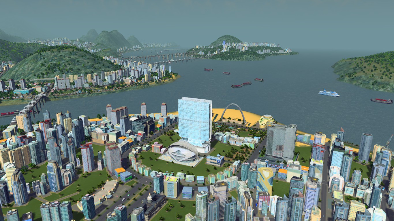
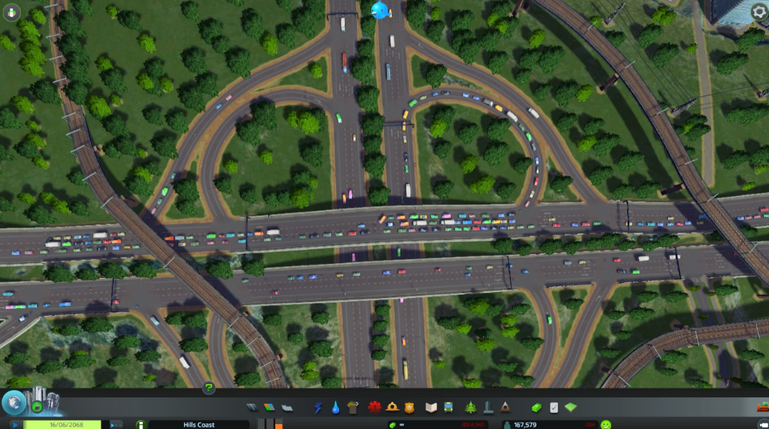
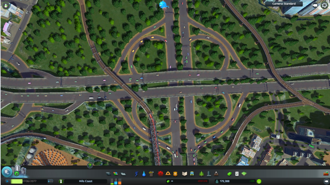
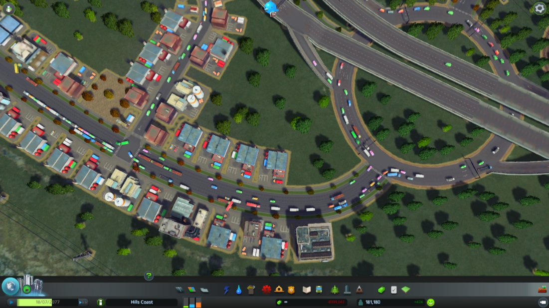
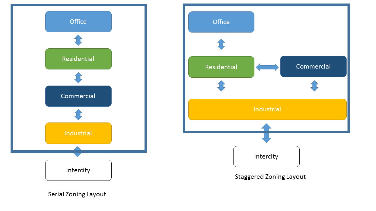
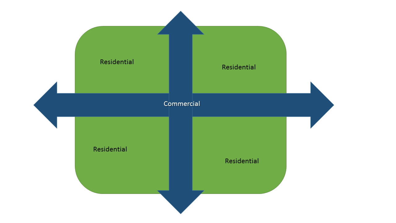
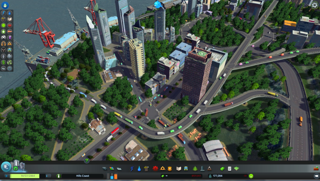
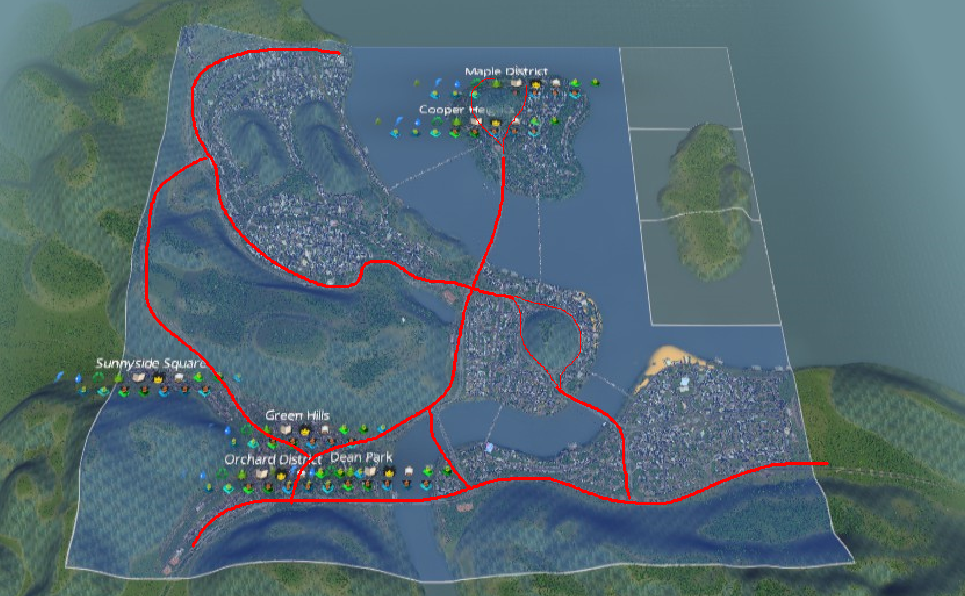
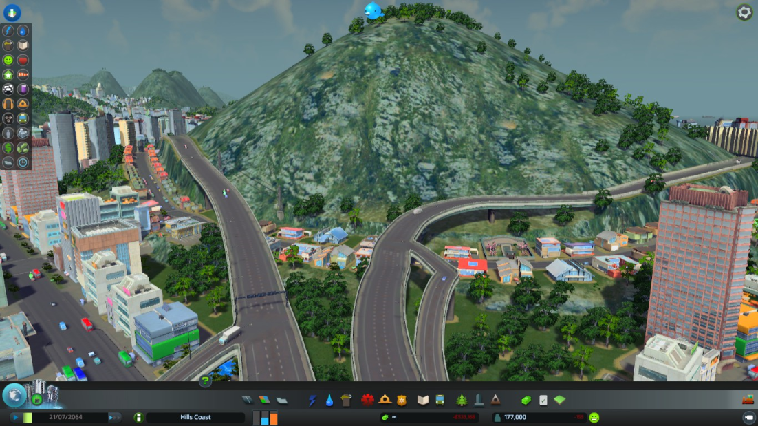
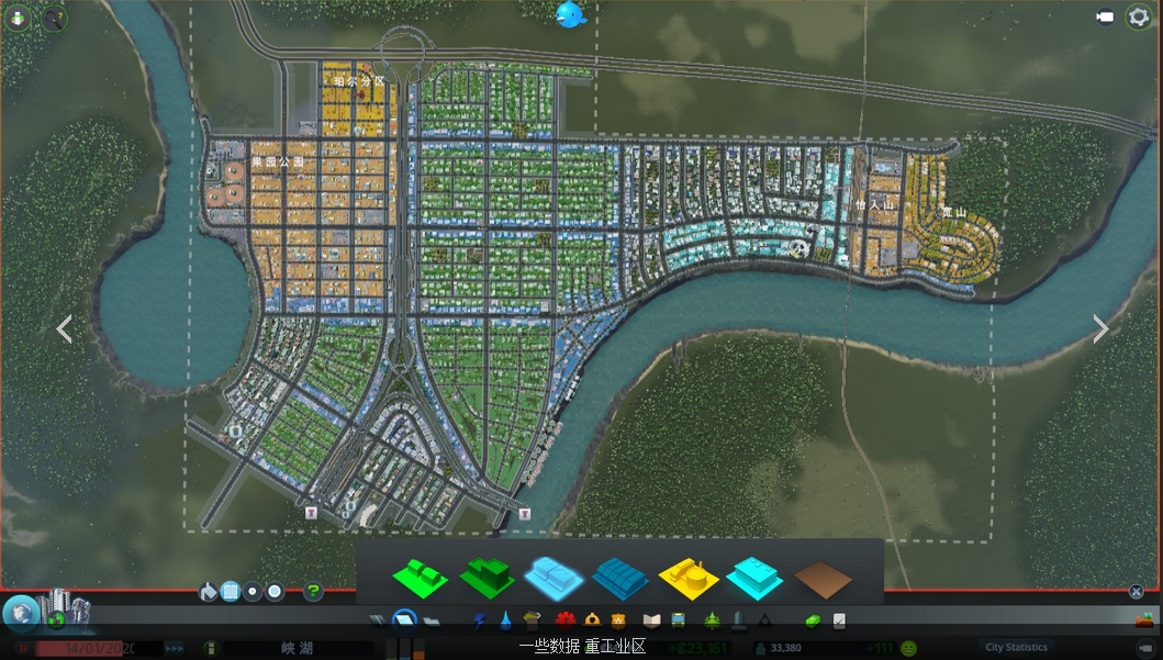
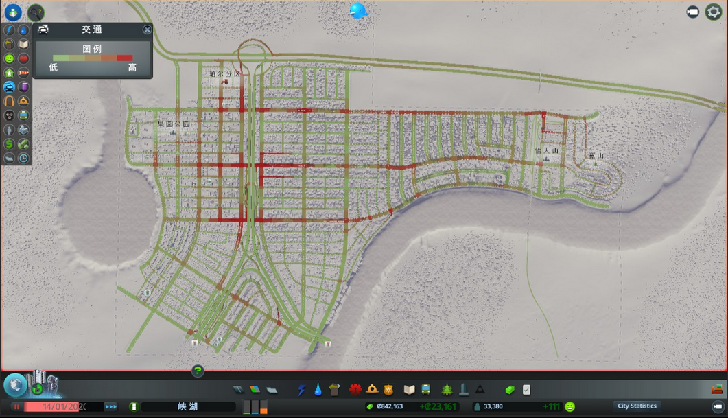
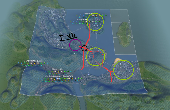
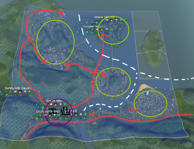
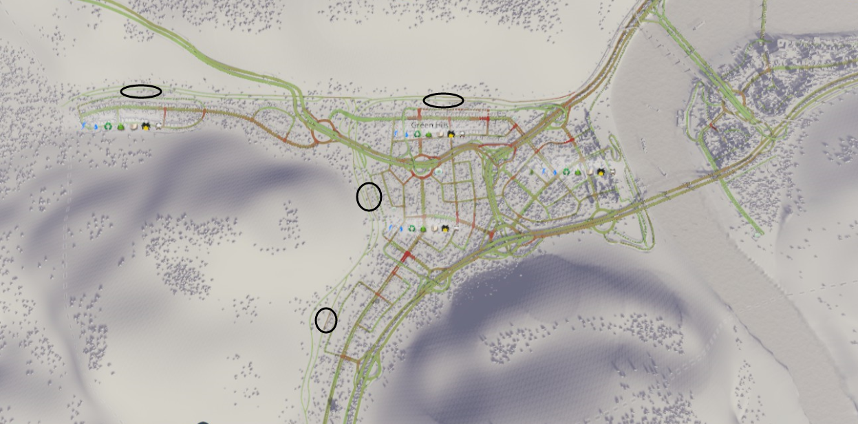
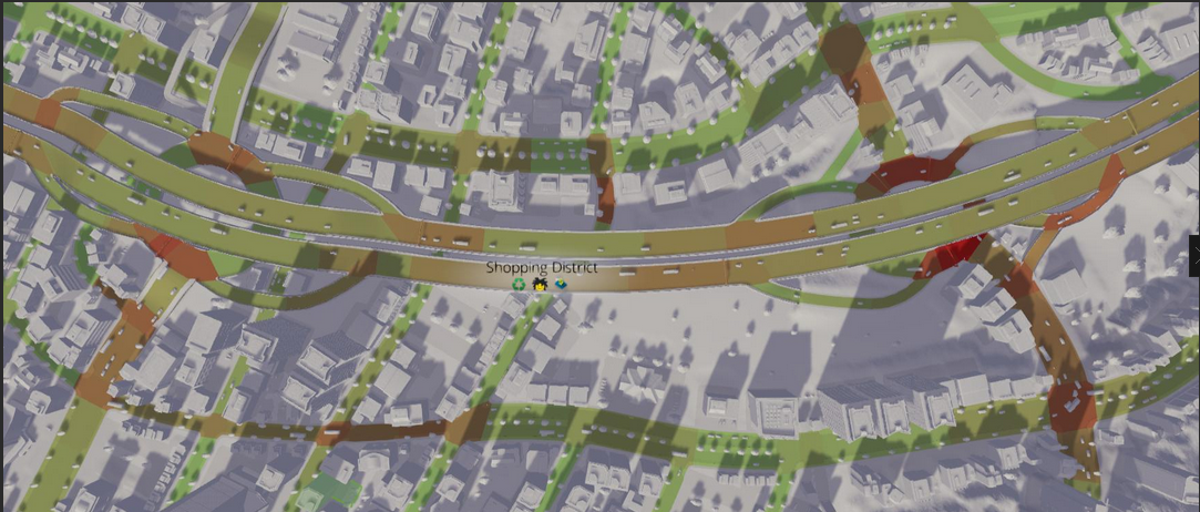
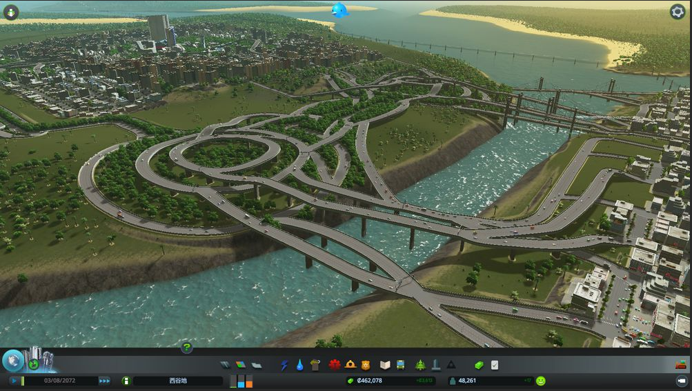
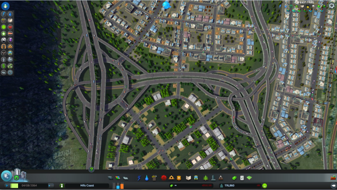
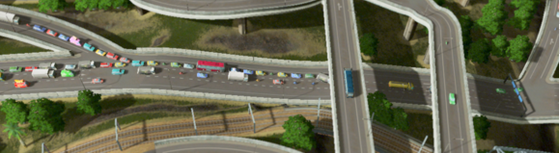
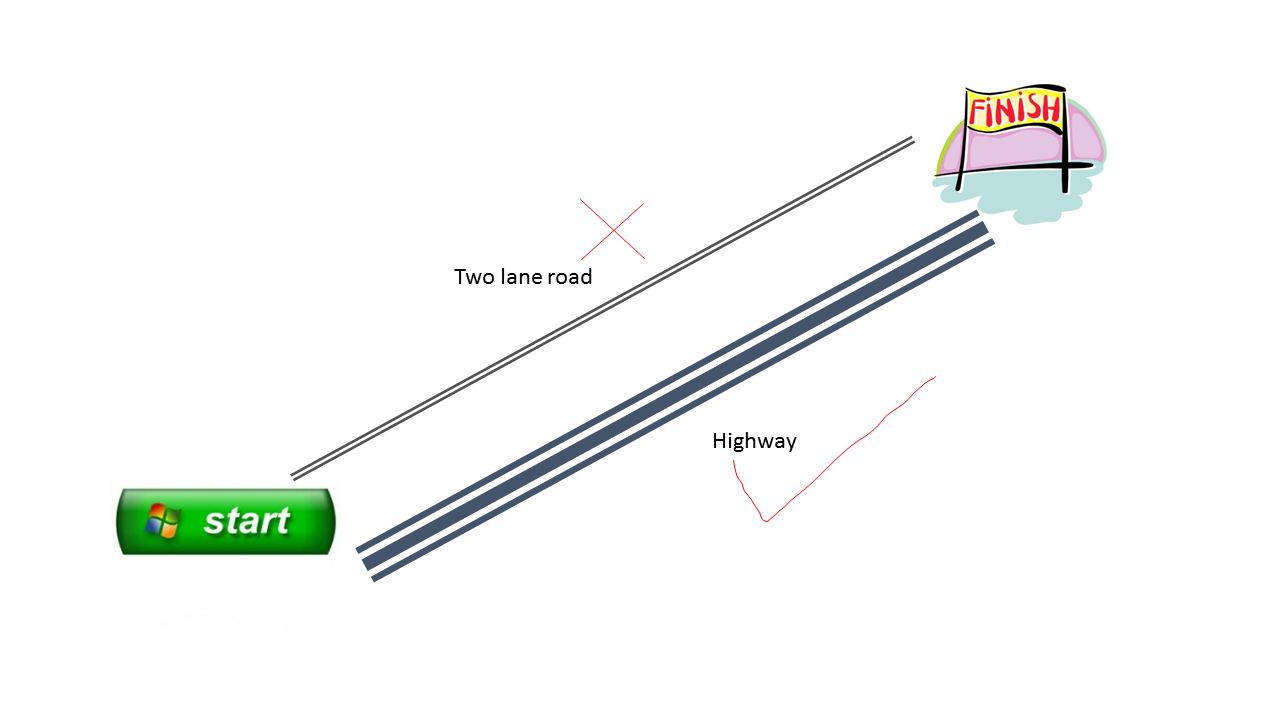
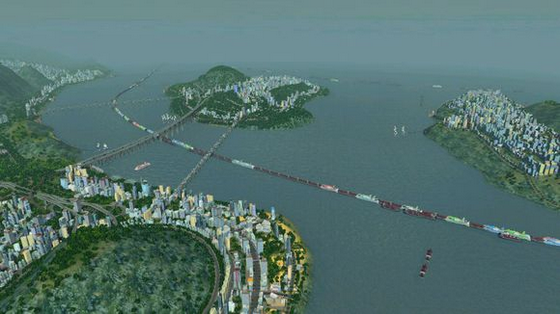
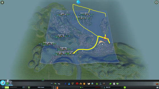
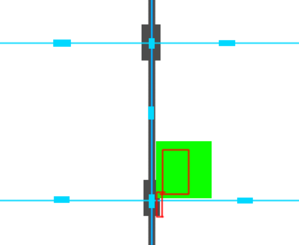
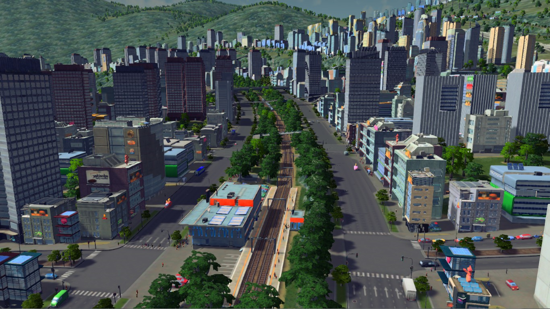
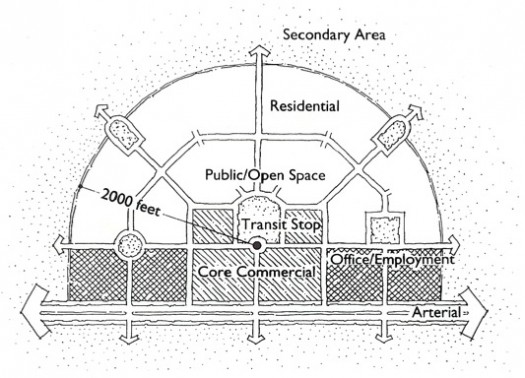
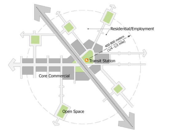
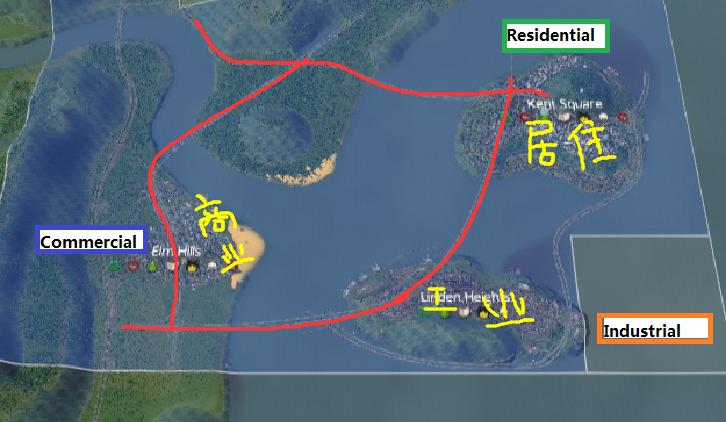
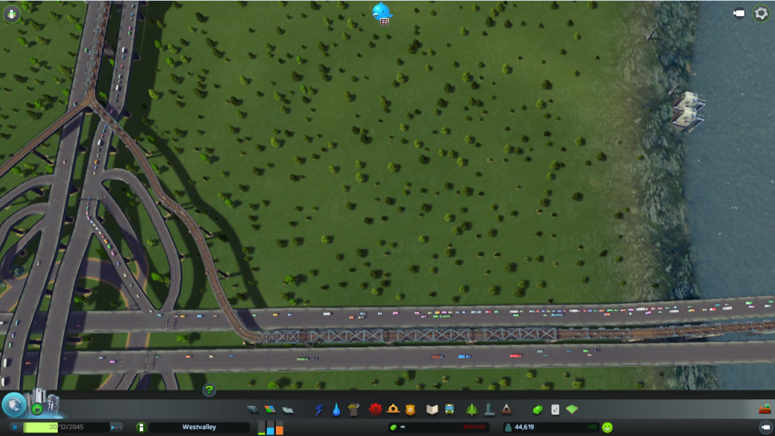
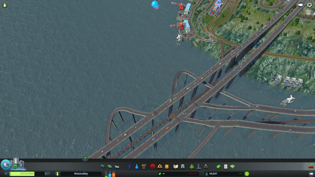
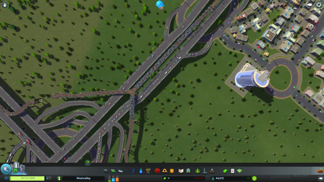
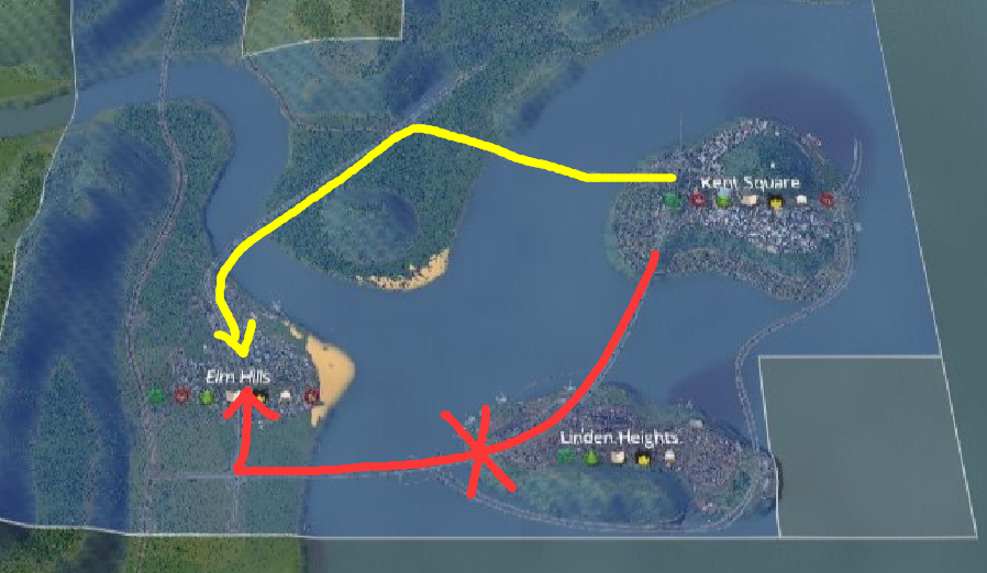
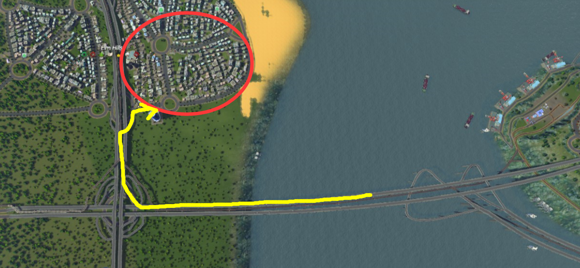
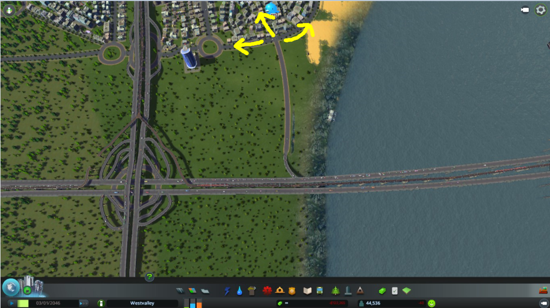
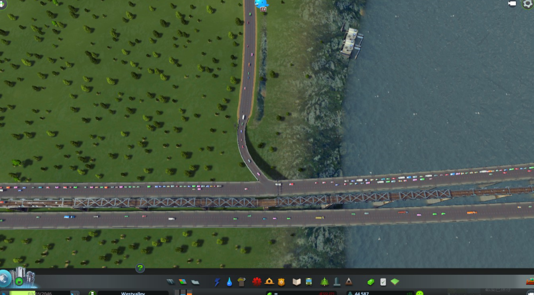
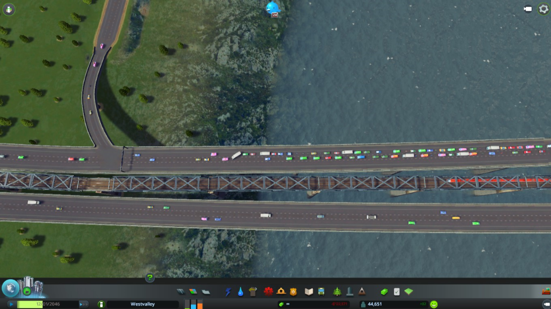
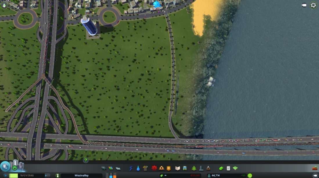
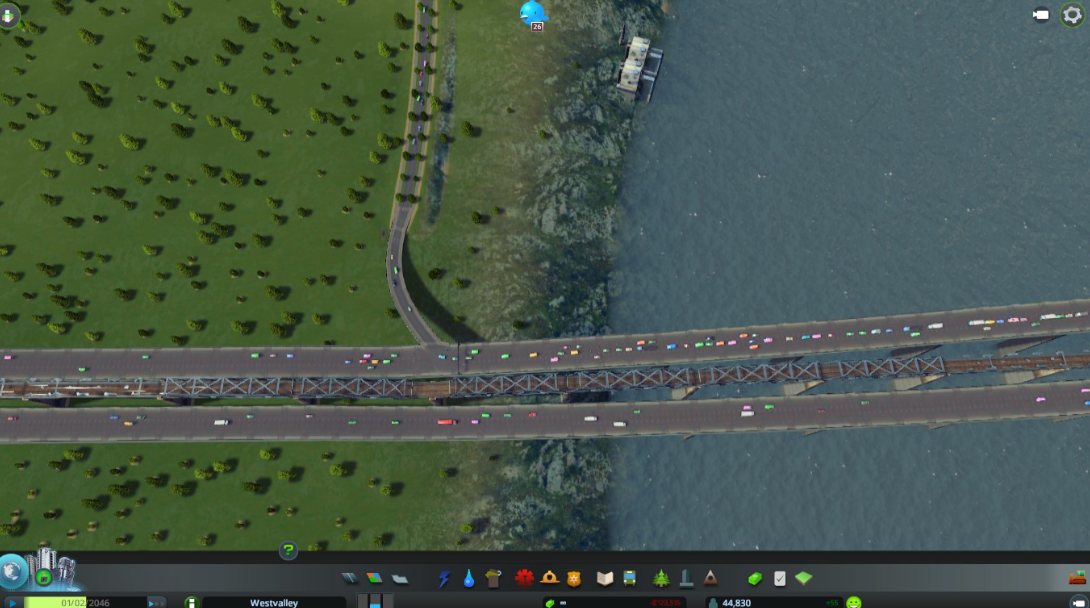
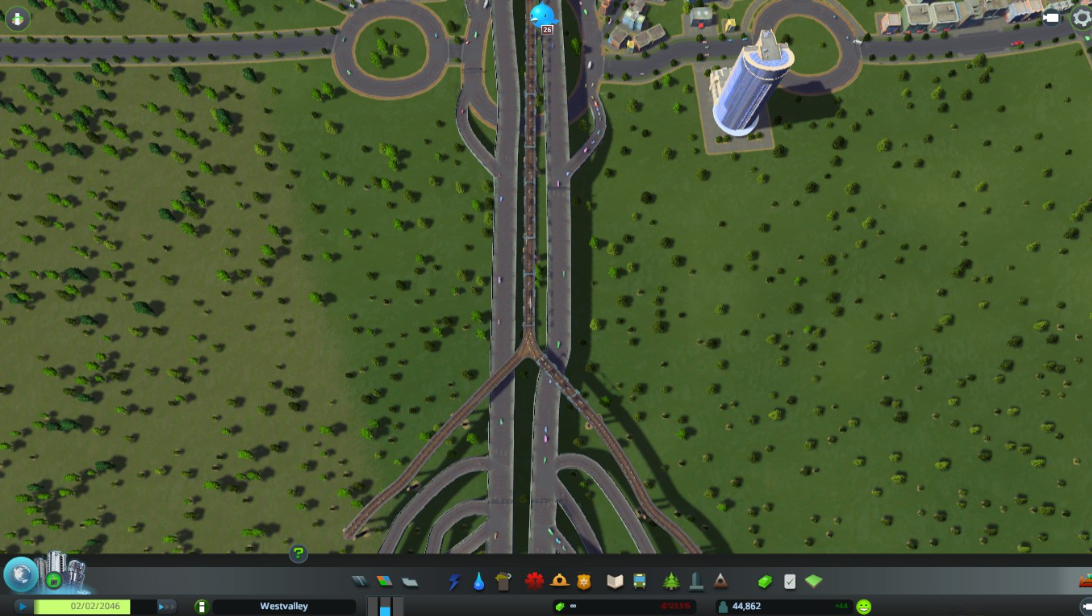
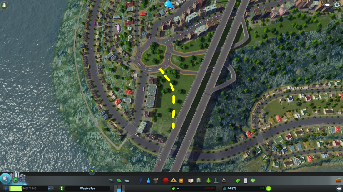
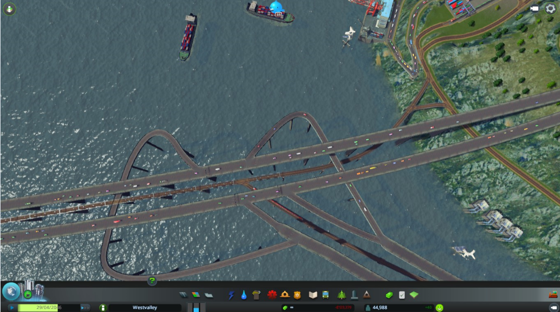
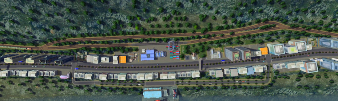
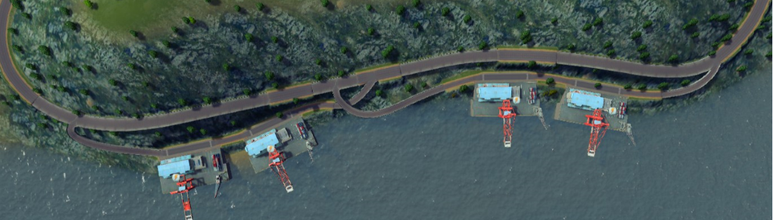
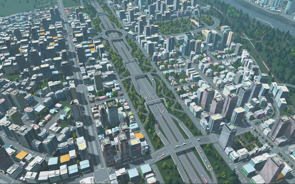
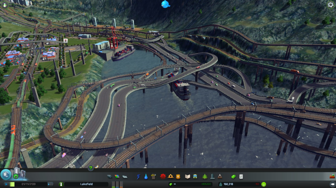
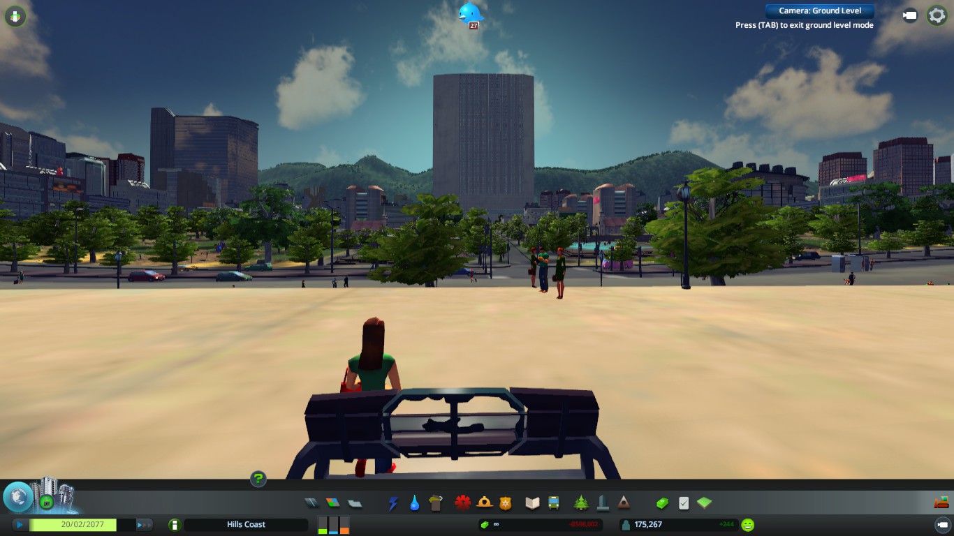
City San Rico - Perfect Zoning for big city (600k population) - NO traffic, NO public transportation NO pedestrian walways!!

https://steamoss.com/sharedfiles/filedetails/?id=2261801686
Beqert 13 Apr, 2020 @ 2:22am 
Absolutely amazing guide! Thanks for your time to talk about things in such details.
Krzyżak 17 Jul, 2019 @ 5:56am 
Reported!

Too good.